
 Image 1 of 7
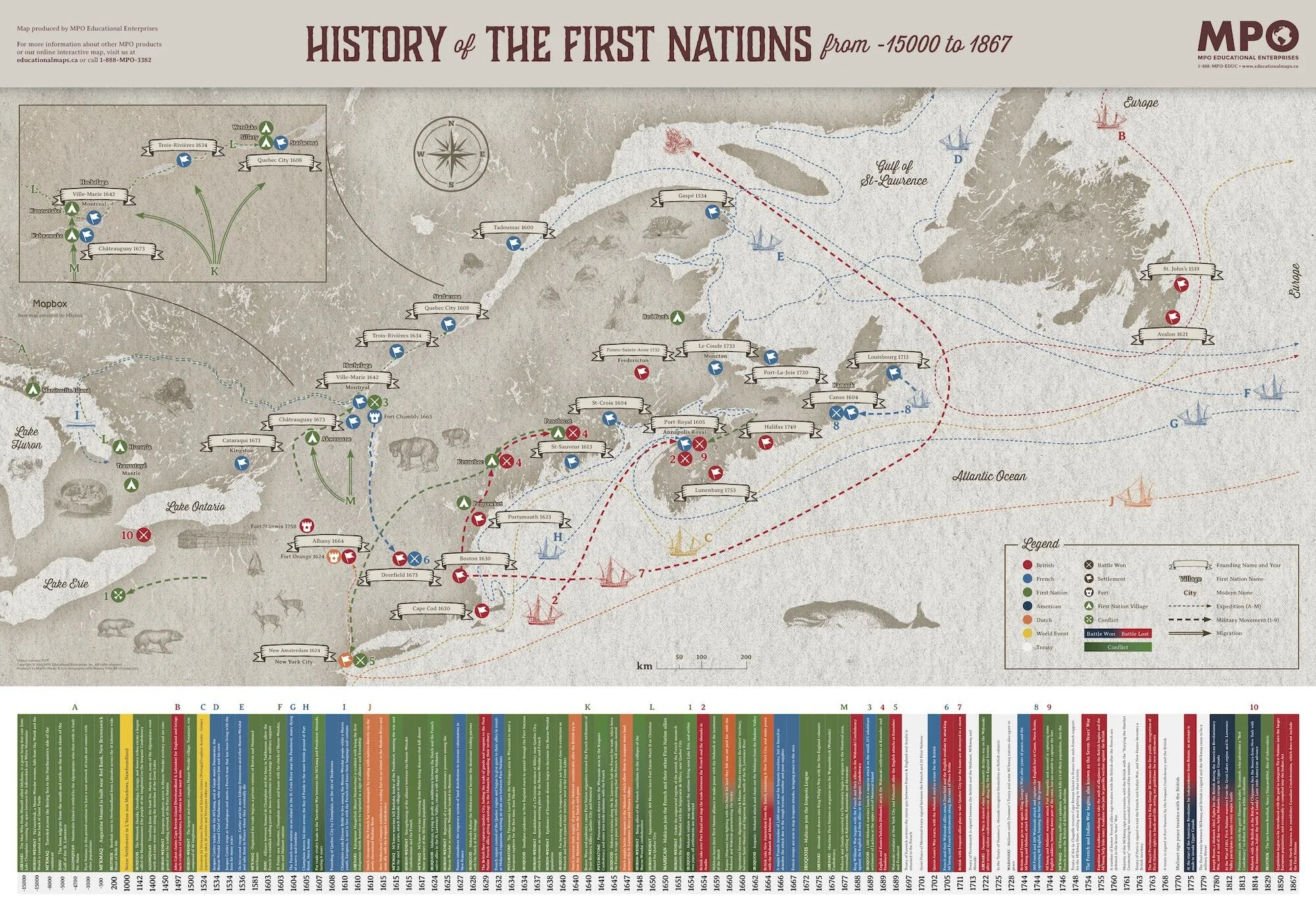 Image 2 of 7
 Image 3 of 7
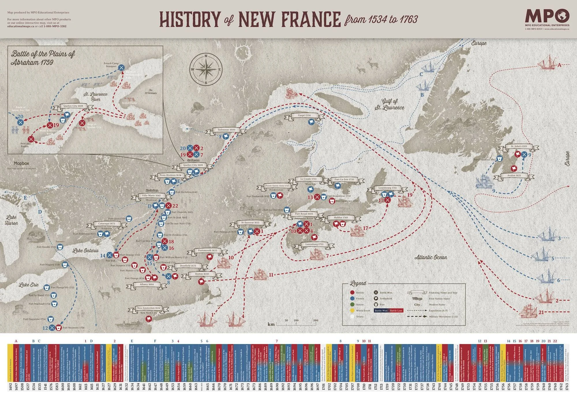 Image 4 of 7
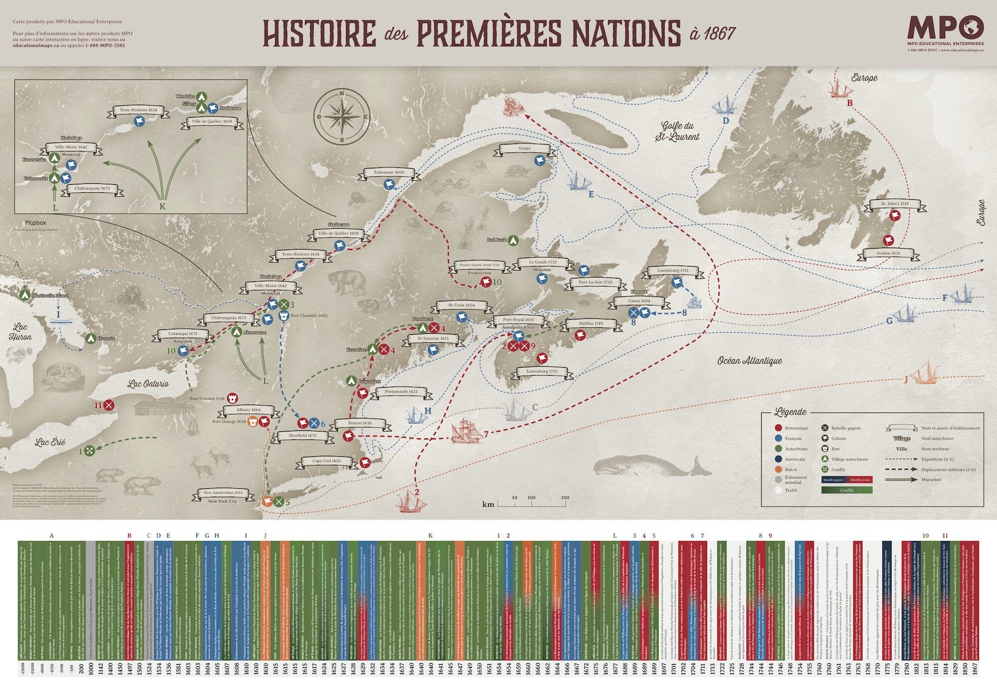 Image 5 of 7
 Image 6 of 7
 Image 7 of 7
The maps were produced by cartographers so they are a great way to demonstrate geographical elements on a map, such as a legend, compass and scale. Map size: 39”x24” or 100x60 cm